Click image to launch:
Launch it: CRACKED EARTH
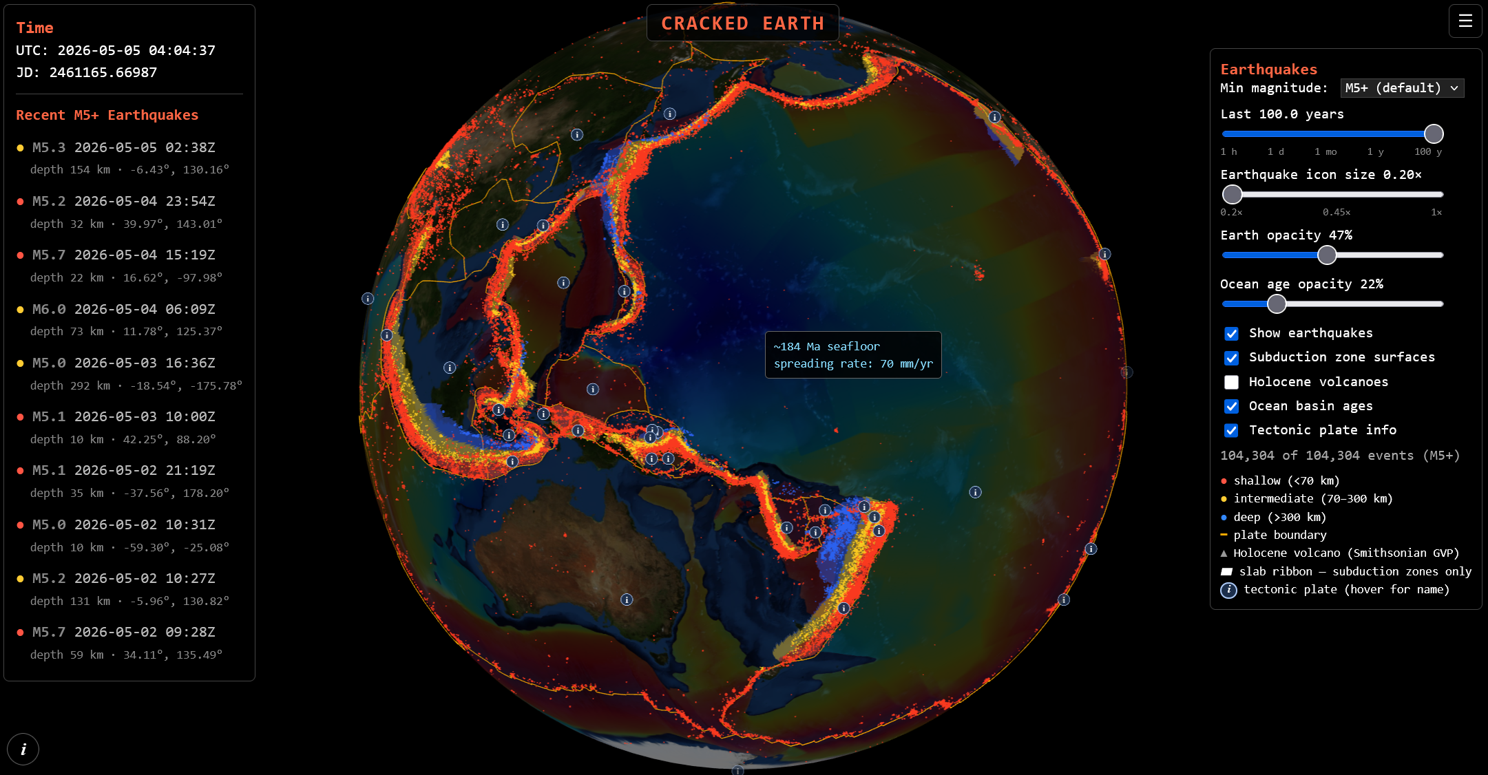
This is a beta release of a pet project I've had on my mind for a long time. I studied Earth Sciences in college and have always been fascinated by this stuff. Meant as an educational tool to show how Earth's major plates interact to create most earthquakes, and how the depth of those quakes can show where subduction zones are. It will also show the ages of the ocean basins and how that relates to plate margins with very deep earthquakes.
For bandwidth reasons, only showing mag 5+ quakes for now.
Data sources:
Earthquakes
USGS FDSN Event Web Service
Subduction slab geometry
Hayes et al. (2018), Science 362, 58–61
USGS Slab2 — ScienceBase data release
Plate boundaries
Bird (2003), G³ 4(3) — PB2002 model
GeoJSON via H. Ahlenius (fraxen/tectonicplates)
Ocean crust age & spreading rate
Seton et al. (2020), G³ 21
EarthByte 2020.1 age + spreading-rate grids
Active volcanoes
Smithsonian Global Volcanism Program — Volcanoes of the World (Holocene)
Earth bathymetry texture
NASA Blue Marble Next Generation w/ Topography & Bathymetry
Made with the help of Claude AI